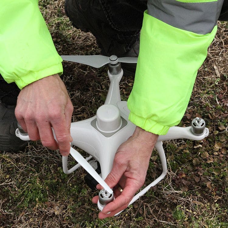
Drones: A Valuable Tool for the Construction Jobsite
Aerial imaging and data gathering via drone is not just a luxury these days, it’s a necessity. Aerial drone data delivers valuable insights during every construction phase, from preconstruction bids to site handoff. There are many ways drones help construction managers save time and money every day.
Orthomosaics
“Orthos” are made by collecting hundreds of photos in a pre-planned flight pattern and altitude. Then, the existing images are stitched together into one high-resolution image. These very high-resolution images offer a high-level look at the entire site without having to leave the workspace.
Benefits include:
- import capability into industry software such as BIM, GIS and CAD for more advanced oversight and
- foundation documentations such as pre-pour certification of what’s inside slabs, the quality of rebar installs and post-tensioning cables;
- façade/structure inspections with no scaffolding and crane inspections with no lock-out/tag-out; and
- landscaping insight on water reach, drainage, final grading and landscape features along with documenting “As Built” conditions before handoff.
Volume Calculations
Volume Calculations give a fast and simple way to measure how much dirt or material is in each pile-keeping inventory and off-haul costs accurate. Earthpile Volumes and Stockpile Counts can be calculated with no ground control or benchmarks simply by using parallax, or the offset between photos of the same image in Orthomosaics. Most stitching software can calculate volumes automatically; contractors should make sure theirs is among those that does.
Overlays
For overlays, contractors are dependent on having access to the plans. Overlays are helpful in several ways including:
- helping to reduce rework for utility pathways and documenting in-ground utilities; and
- visually showing position of site plans for utility, runoff and equipment clearances on the actual site as it develops and comparing real-time site conditions against the plans.
This can help catch conflicts early and correct them before they become big problems later.
Contours
Contour measurements allow for more active and competitive pre-bids and accurate site balancing for final grading. To calculate contours, lay ground control points and fly a precision mission. Not all software can provide accurate contours, so make the chosen software can.
Progress Photos
Progress photos are one of the easiest items to capture and deliver. The key is to deliver photos from the same angles and altitudes each time so that clients can easily recognize specific progress each time. In most cases, these flights can be automated so that they can be repeated. However, keep in mind that using programmed flight routes and angles can be dangerous with constantly changing site altitudes and crane heights and positions. The standard way of accomplishing this task is to automate the task but on the day of any flight, double-check altitudes and use a drone with obstacle avoidance systems.
Be sure to include shots of any new progress, perceived problem areas and especially anything that may have been a challenge.
Video
Owners may not make it to the site often, and a video keeps them engaged with their “baby” as building progresses. Editing the video can be challenging if one has never done it before, but there are plenty of free tutorials and free software that will allow the project to be completed.
Questions to Ask Before Flying the Site For Commercial Purposes
Is the pilot certified by the FAA? The pilot needs FAA Part 107 certification to legally fly the site.
Is the airspace clear for flight? If the jobsite is in controlled or restricted airspace, pilots must obtain an authorization or waiver to fly there. If the contractor hires an unlicensed pilot or allows the pilot to fly without proper authorization on a site, the contractor could be held liable for non-compliance.
Does the drone service provider have insurance? A drone service provider (even if they work for the company) should have a standard policy of at least $1 million in liability with $10 million not uncommon for construction site drone operators. Just like with everything else, insurance is not important until is needed.
What is the pilot’s experience with active construction sites? Apart from insurance, this is probably the most important question of them all. Flying a busy site with constantly moving heavy machinery and open hazards requires experience, concentration and a safety-first mentality. Make sure the drone pilot understands this and has the necessary experience before they add an aircraft to the equation.
What can the pilot provide and how will it be delivered? Drones can provide valuable insight quickly, safely and be very cost-effective compared to traditional methods. However, too much data can be overwhelming. Know the goals ahead of time and work with the drone pilot to achieve those goals. Define the need for interpretation. If data analysis and reporting is needed, find a provider (or software) who has the resources to do this in the format needed.
How often is a flight needed? Whether it’s a weekly mission with 24-hour turnaround or an unscheduled flight to document site conditions after a weather event, contractors need to know that they are going to get the service they want and need.
Finding an experienced and capable drone provider can take time, but asking the right questions will put a contractor on the path to making these flight safe, and profitable.


Related stories